


A KSM drill rig perches above a deep valley about 80 miles east of Wrangell. (Photo by Ed Schoenfeld/CoastAlaska News)
British Columbia’s Kerr-Sulphurets-Mitchell mining project wrapped up
its 2015 exploration season in late September. The KSM, about 30 miles
east of the Alaska border, is the largest of 10 or so such projects near
waterways that flow into Southeast.
Its owner, Toronto-based Seabridge Gold, The Kerr-Sulphurets-Mitchell (KSM) mine, owned by Seabridge Gold, is located approximately 65km north-west of Stewart in British Columbia, Canada. It is one of the world's biggest gold / copper projects under development has already spent close to $200 million searching for ore. We take you there, during the previous season, to learn about the exploration process.
A drill rig grinds into the bedrock of a high ridge, overlooking a
wilderness of snow-capped mountains and lushly vegetated valleys. The
bright blue rig juts up through the roof of a rough shack of sturdy
tarps, sheets of plywood and heavy timber.
Inside, Jeff Skinner is setting up the diesel-powered, hydraulic drill rig for its next run.
“Well, we’re doing mineral exploration for these gentlemen. We’re
drilling the hole, pulling the rock samples out of the ground and
sending them down to the geologists and they take care of it from
there,” he says.

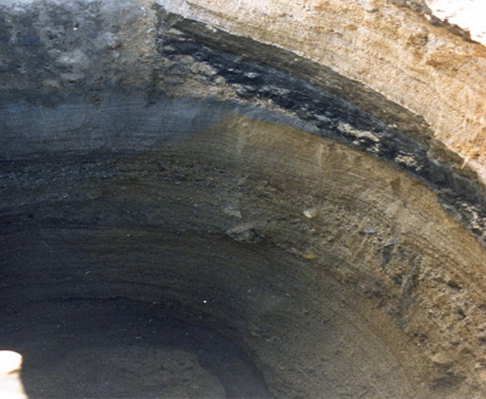
A glacier reflects in a naturally
occurring pool of rusty, acidic water at the site of one of the KSM
prospect’s planned open-pit mines. (Photo by Ed Schoenfeld/ CoastAlaska
News).
Long, brownish pipes are lined up outside the shack, waiting to be used.
“They put the steel in a giant drill chuck like you’d have in a hand
drill. And turn it at high speed with a diamond bit at the end,” says
Bill Threlkeld, senior vice president for exploration for Seabridge
Gold, which has drilled 383 holes at the KSM over the past 10 years.
The pipes are sent deep into the ground and an inner sleeve brings
back cylindrical samples, called cores. Threlkeld says they help
pinpoint the location of the richest gold and copper deposits.
“It was at roughly 700 meters depth, so 2,100 feet, more or less,
down. Before the work on this hole is done, the drill will reach more
than two-thirds of a mile into the Earth,” he says.
“We have Mitchell 0-6, so it’s Mitchell, drilled in 2006, zero-one, first hole,” he says.
He’s taken me to near the end of a valley that can only be described as “raw.” It’s bare rock, with no trees or bushes.
At the valley’s upper end is what’s left of the glacier that once
filled this U-shaped valley. Murphy says “once” wasn’t that long ago.
“We’re walking to an area where six years ago, where we’re standing,
the ice would have been 10 feet above our outstretched arms. So you can
see how much it’s receded,” he says.
The valley is splotched and streaked with rust, reddish-brown streams
flowing down its sides. The color comes from exposed iron, which reacts
with air and water.

Sulphurets
Creek, which drains naturally occurring rusty water from the KSM
prospect, enters the Unuk River. (Photo by Ed Schoenfeld/CoastAlaska
News)
Acidic water from mines and stored waste rock can hurt or kill fish, including those Alaskans depend on for food and jobs. KSM developers say it will be treated and stored properly at the site, about 80 miles east of Wrangell. Critics in Southeast cast strong doubts.
Up one side of the valley is a much different color. It looks like someone spilled a very large can of paint while ascending the ridge.
The blueish-green is just an indication that there’s copper in the
system here. It gets exposed to the atmosphere and the copper comes out
of solution. It’s an indication we’re in a mineral-rich area.

Because in this part of the world, where you find copper, you find gold.
After the cores are drilled out of the bedrock, they’re flown by
helicopter to the KSM’s analysis operation, farther down the valley.
They’re cut into clearly labeled pieces for examination.Inside another wood-and-tarp building, Michelle Campbell points to
the computer screen of what’s called a hyperspectral imaging device.
“A regular camera just looks at three spectral bands. But this one
looks at 214 different spectral bands, so it’s much more precise,” she
says.
The picture is electronically enhanced to show what’s on the surface
of the rock core. She’s happy with what she sees, the presence of
valuable metals.
“So in this one it would be like the reds and some of these darker, like brownie, colors. [They’re] the good stuff,” she says.
The cores and the enhanced images undergo further scrutiny before
being shipped south for more detailed analysis by an independent lab.
Those results determine whether and where the company will mine.

Rock
cores wait for analysis at the Kerr-Sulphurets-Mitchell project, one of
the British Columbia mines planned for near the Southeast Alaska
border. (Photo by Ed Schoenfeld, CoastAlaska News)
Source : News Gold Mining In The World
 /*
/*